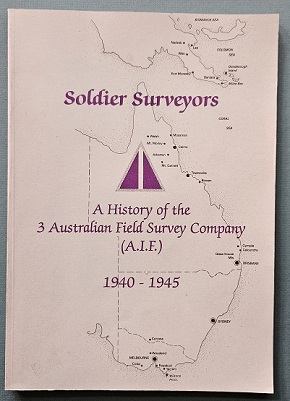
Description
Title: Lebanon to Labuan – A story of mapping by the Australian Survey Corps, World War II (1930 to 1945)
Author: Fitzgerald, Lawrence
Condition: Near Mint Plus
Edition: 1st Edition
Publication Date: 1980
ISBN: 0959497900
Cover: Hard Cover with Dust Jacket – 124 pages
Comments: The detailed history of the Australian Survey Corps during World War II.
The Royal Australian Survey Corps (RASvy) was a Corps of the Australian Army that was formed on 1 July 1915 and disbanded on 1 July 1996.
In July 1939 ‘Instructions for War – Survey’ were issued.
This outlined the military survey organisation to undertake an emergency mapping programme and the nucleus for expansion to war establishment. The emergency mapping programme was for strategic mapping at scale 4 miles to 1 inch covering a coastal strip 200 miles (300 km) inland from Townsville to Port Augusta and 100 miles (200 km) inland from Albany to Geraldton and key strategic areas in Tasmania and around Darwin. Map production was from existing State information and conducted jointly between State and Commonwealth agencies and Survey Corps units.
The programme expanded to include more of Australia, New Guinea, New Britain and New Ireland and although many maps were of a preliminary standard only, they provided general coverage critical at the time. Initially the Survey Corps proceeded with programmed tasks and survey units were established as RAE militia units.
In late 1940 expansion of the Survey Corps was approved to include militia units. Four militia Field Survey Companies were established in the military districts and absorbed the Corps Sections in those districts. In early 1941, 2/1 Corps Field Survey Company RAE, sailed with the 2nd Australian Imperial Force, to provide survey and mapping to the Australian Corps in the Middle East theatre. Over the next four years fifteen Corps units with various roles provided survey and mapping support to military operations in the South West Pacific Area theatre of the war including Northern Territory, Papua, New Guinea, New Britain, New Ireland, Bougainville, Dutch New Guinea, Borneo and the States of Australia in particular northern Australia. Women of the Australian Women’s Army Service served in Survey units and formation headquarter sections in Australia and in New Guinea.
The value of survey support within combat forces was well acknowledged, with Survey Sections assigned to both 7th Division and 9th Division for the large scale amphibious landings in Borneo. The Corps produced more than 1400 new maps of the theatres of war, printing more than 3 million copies of the maps. The highly valued efforts of the Corps did not go unnoticed by senior commanders. Lieutenant-General E.F. Herring, General Officer Commanding New Guinea Force and Lieutenant-General J. Northcott, Chief of the General Staff wrote letters of appreciation of the work of the Corps to the Director of Survey, Advanced Land Headquarters. General D. Macarthur, Commander-in-Chief, South West Pacific Area wrote a letter of high commendation of Corps work to General Blamey, Commander, Allied land Forces, South West Pacific Area.
At Morotai in Borneo, the Mobile Lithographic Section was given the privilege of preparing the Instrument of Surrender signed by Lieutenant-General Teshima, Commander, Second Japanese Army and countersigned by General T. Blamey, Commander-in-Chief, Australian Military Forces. The unit then printed thousands of copies of the surrender document for souvenirs. At the end of the war more than half of the Corps strength of 1700 were on active service outside Australia.
The achievement of the Corps during the war was its greatest contribution to the nation than any other during its existence. This was duly recognised in 1948 when King George VI granted the title ‘Royal’ to the Australian Survey Corps.
Corps units in World War II were:
Survey Directorate Land Headquarters – Melbourne, Dutch New Guinea, Borneo
2nd/1st Army Topographical Survey Company, formerly 2nd/1st Corps Topographical Survey Company – Middle East, New Guinea, Dutch New Guinea, Borneo
No 6 Army Topographical Survey Company, – Victoria, Northern Territory, Western Australia, Queensland, New Guinea, Dutch New Guinea
Land Headquarters Cartographic Company, formerly Army Headquarters Cartographic Company – Melbourne and Bendigo Victoria
No 2 Field Survey Company – New South Wales, New Guinea, New Britain, Bougainville
No 3 Field Survey Company – Victoria, New Guinea
No 4 Field Survey Company – Western Australia
No 5 Field Survey Company, formerly 1 Field Survey Company – Queensland, Dutch New Guinea, Borneo
No 7 Field Survey Section, formerly Northern Territory Force Field Survey Section – Northern Territory
No 8 Field Survey Section, formerly New Guinea Field Survey Section and No 2 Field Survey Section – New Guinea
No 1 Mobile Lithographic Section, formerly 2 Army Survey Mobile Reproduction Section – Melbourne, Brisbane, Borneo
No 11 Field Survey Depot – Bendigo
No 12 Field Survey Depot – Queensland, Borneo
No 13 Field Survey Depot – Sydney, New Guinea
Field Survey Training Depot – Victoria
Includes list of officers of the Australian Survey Corps


